")
")
 The Bird Control Unit of Airforce base Woensdrecht and Deelen started an innovative project, using a drone equipped with a multispectral camera in order to map the vegetation next to runway and taxiways. Managing the vegetation phase of grass in this area will make it unattractive for birds to find food and this can contribute to flight safety. Also other vegetation and water close to the runway can be mapped and monitored.
Before the delivery of their own RPAS system the Bird Control Unit started the pilot project with RPAS Services and Aironov to gain more insight into the innovative applications of drone images and the complex data processing.
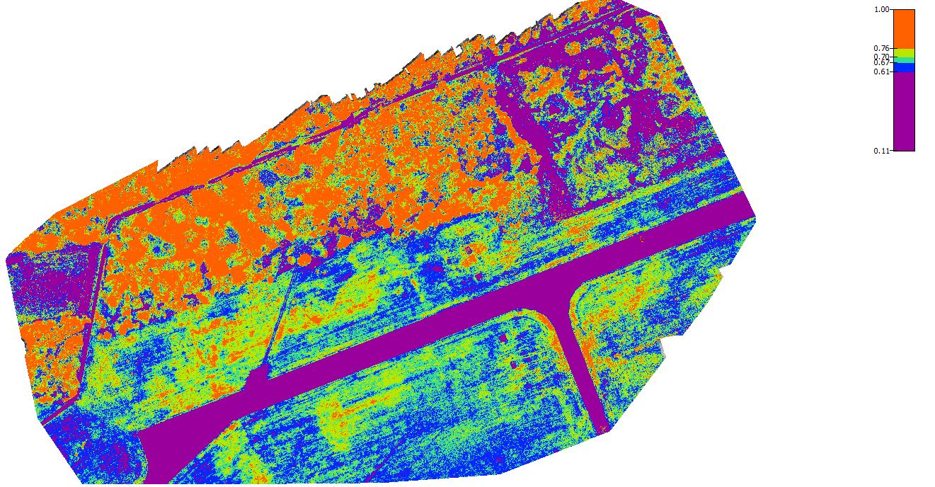
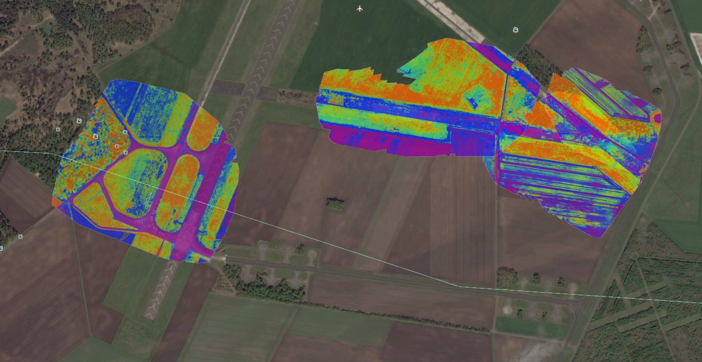
RPAS Services is using a drone equipped with the latest multi-spectrum camera, the Parrot Sequoia. With this camera, it is possible to measure the reflections of vegetation, such as the grass along the runway, in four different frequency bands of visible light to near infrared.
RPAS Services will map a test area on the airfield and process the data with PIX4D which will result in reflectance maps and vegetation indices reports. Grass samples of this test area are analyzed in the laboratory and Aironov has analyzed the correlation and condition of the vegetation.
Ultimately, this will make it possible to recognize the various stages of grassland on the landing zone by using drone images. This allows the Airforce quickly and accurately understand the condition of vegetation on the ground, manage this and identify wet bird attracting locations.